The Upper Mississippi River System (UMRS) is one of this nation’s unique natural resources. It encompasses the commercially navigable reaches of the Upper Mississippi River, as well as the Illinois River and navigable portions of the Kaskaskia, Black, St. Croix and Minnesota Rivers. This complex river system is made up of a mosaic of main channel, side channel, backwater, floodplain, and wetland habitat that contains a diverse assemblage of flora and fauna.
While there are abundant studies focusing on individual species present in the UMRS, ecosystem level processes are not well known. In order to better understand these processes, the Long Term Resource Monitoring element (LTRM) was implemented on the UMRS. LTRM field stations are located from Pool 4 (Minnesota) through the Open River (Missouri).
Funded by the U.S. Army Corps of Engineers (USACE) through the Upper Mississippi River Restoration Program (UMRR) and implemented by the U.S. Geological Survey’s (USGS) Upper Midwest Environmental Science Center (UMESC), the LTRM element provides monitoring on a number of resources including fish and water quality.
Data obtained by the LTRM element is used by various agencies including the USACE, who uses data to aid in the development and maintenance of commercial navigation (barging industry). Individual state agencies also use LTRM data to survey species populations and trends, primary production, sediment loads, etc. While the LTRM element is designed as an ecosystem-wide monitoring program, many other studies have been completed by personnel working under the LTRM system.
The Illinois River Biological Station (IRBS) has worked with four components of the LTRM including macroinvertebrates (1993–2004), vegetation (1991–2004), fish community (1990–present) and water quality monitoring (1990–present).
Fish Community Monitoring
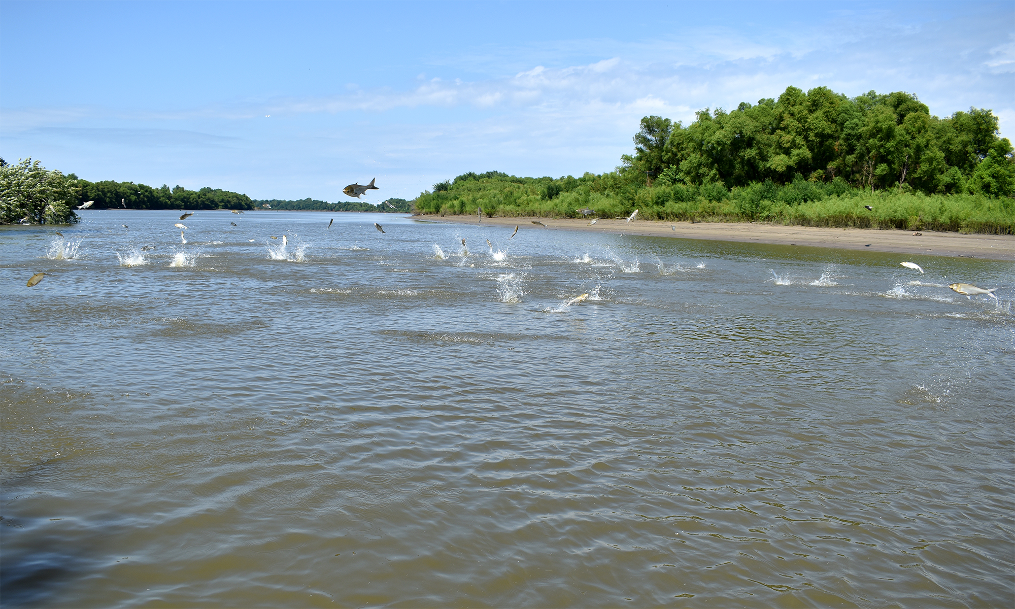
As part of the Long Term Resource Monitoring element (LTRM), we have monitored fish communities in La Grange Reach of the Illinois River since 1990. Sampling from 1990-1992 was at fixed sites throughout the reach. However, beginning in 1993, we implemented a stratified random sampling design to encompass the entire 80 mile La Grange Reach.
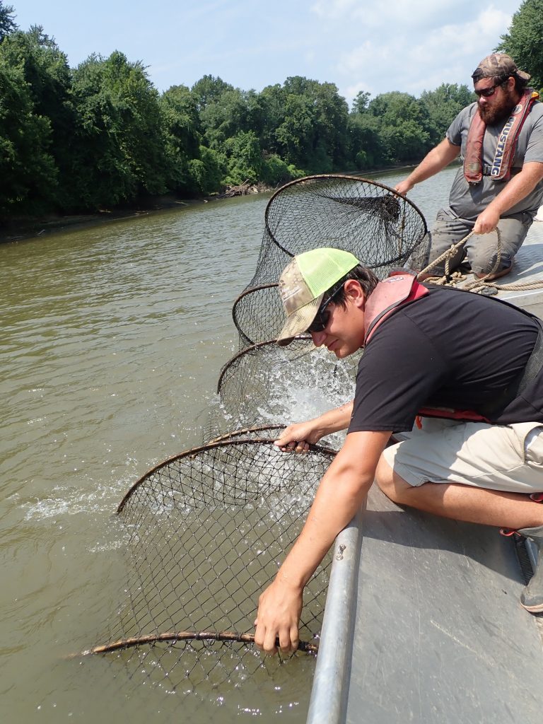
Currently, IRBS uses Wisconsin style fyke nets, minifyke nets, large and small hoop nets, trawls, and boat mounted pulsed DC electrofishing to sample approximately 122 randomly selected main channel border, side channel, and backwater sites in La Grange Reach during each of three six-week sampling windows annually (June 15–Oct 31).
Major backwater areas IRBS samples include Pekin Lake, Big Lake, Clear Lake, Quiver Lake, Matanza Lake, Crane Lake, Chain Lake, Treadway Lake, Muscooten Bay, and Lily Lake.
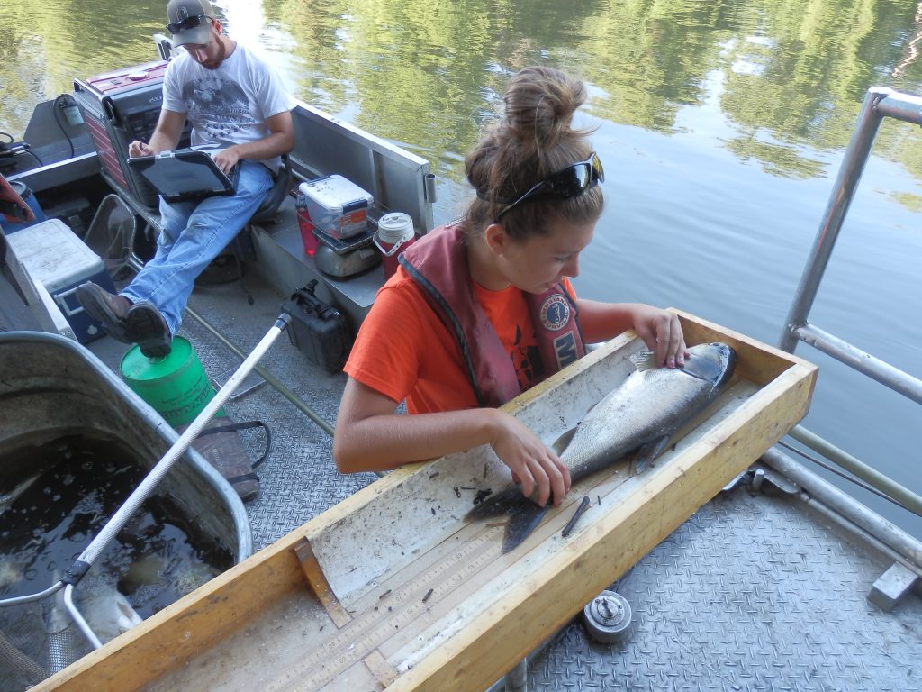
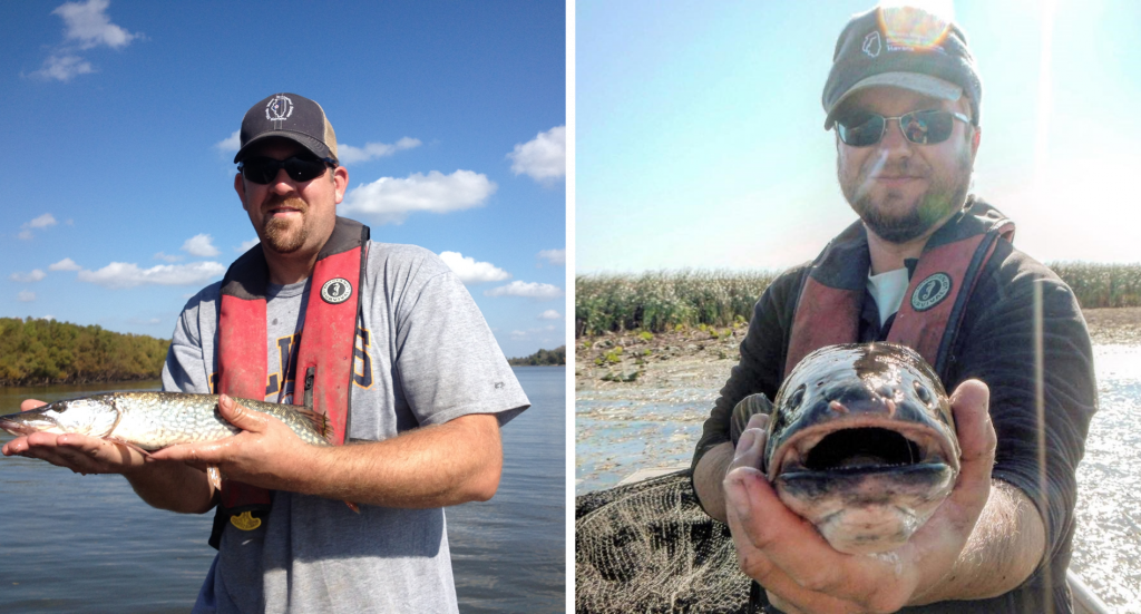
IRBS fish community sampling results in approximately 366 samples and 50,000 fish per year. Many turtles are taken as bycatch during the sampling; these data are recorded in a separate database. Data taken for fish and turtle species includes species identification, length, weight, and any abnormalities/deformities.
LTRM fish monitoring data from 1990-current are available from the USGS Upper Midwest Environmental Sciences Center’s home page and at IRBS.
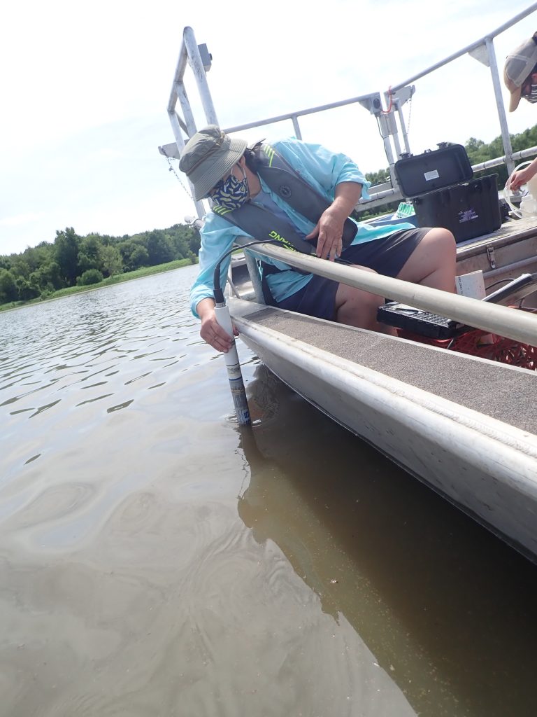
Water Quality Monitoring
IRBS has monitored water quality in the La Grange Reach of the Illinois River since 1989 as part of the LTRM.
IRBS sampled approximately 25 fixed sites every week from 1989–1993. In 1993, IRBS switched to sampling once every two weeks at 13 fixed sites (including 5 major tributaries) and seasonal Stratified Random Sampling (SRS)—a seasonally intensive sampling (i.e., four times per year) at 135 main channel, side channel, and backwater sites throughout the reach.
IRBS recently dropped 2 fixed sites and changed their sampling frequency due to funding issues. Researchers now sample fixed sites bi-monthly April–June and monthly in January, March, August, September, October, and November; no fixed site sampling takes place in February or December. Stratified random sampling (SRS) still takes place as it has since 1993 (except for in 2002, when no SRS was done).
Along with main channel and side channel habitats of the La Grange Reach, IRBS also monitors water quality in major backwater areas including, Quiver Lake, Matanza Lake, , Chain Lake, Stewart Lake, Treadway Lake, Muscooten Bay, and Lily Lake, and tributaries including the Mackinaw, Spoon, Sangamon, and La Moine rivers.
Some of the parameters measured at these sites include depth, secchi, temperature, dissolved oxygen, conductivity, pH, and velocity. One water sample is taken back to the lab and analyzed for turbidity, suspended solids, chlorophyll, and phytoplankton. Other water samples are collected, preserved, and later analyzed in a lab for different nutrients such as total nitrogen and total phosphorus just to name a few.
More information and water quality data are available online at the UMESC LTRMP water quality page.
Sara Sawicki leads the LTRM water quality monitoring on the La Grange Reach of the Illinois River at IRBS.